Plate Tectonics, Earthquakes, and Volcanoes
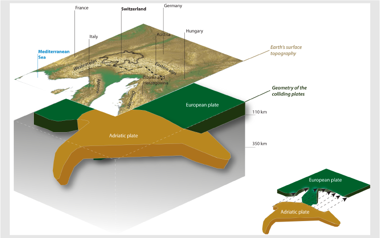
Germany has no tectonic plate boundaries that run through it, but it is still influenced by them. The biggest example would be the African Plate colliding with the European Plate, smashing the Adriatic Plate between them. This is what caused the Bavarian Alps to form, which, while spread throughout the region, has a major impact on Germany’s climate. The boundary is a convergent plate boundary.
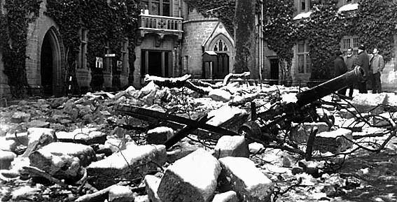
Germany experiences minor earthquakes, with the most active region being the Lower Rhine Graben in western Germany. In 1992, the Roermond Earthquake (magnitude 5.8) caused damage in western Germany.
Rock and Mineral Resources
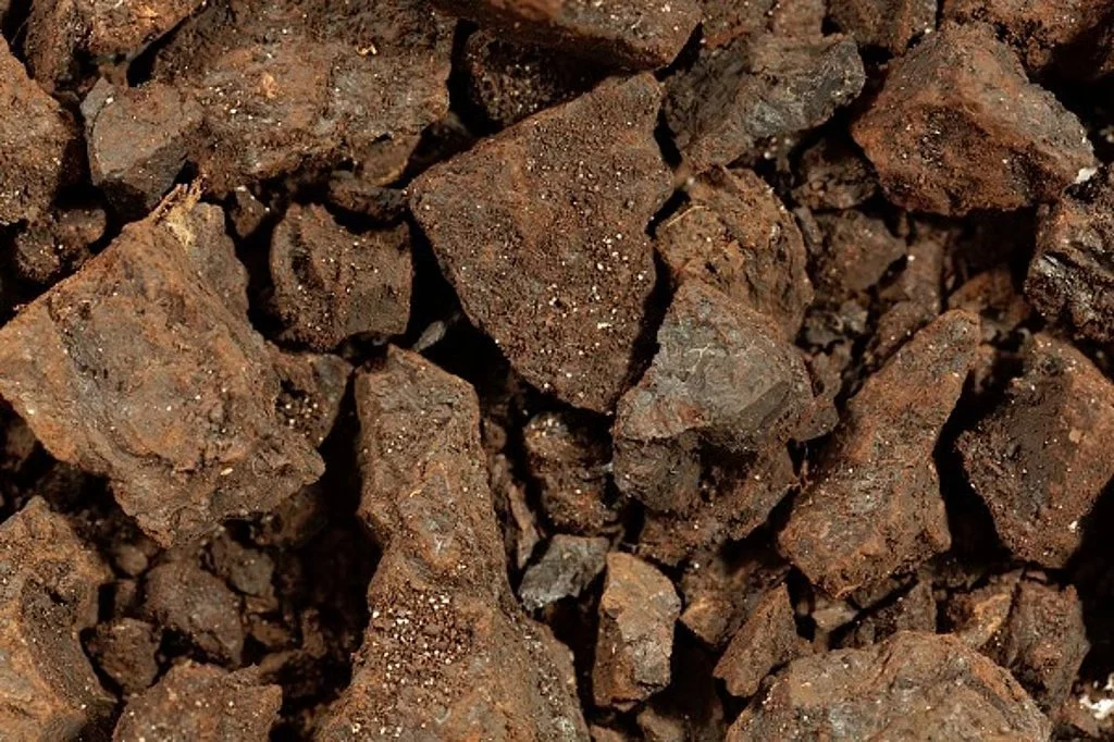
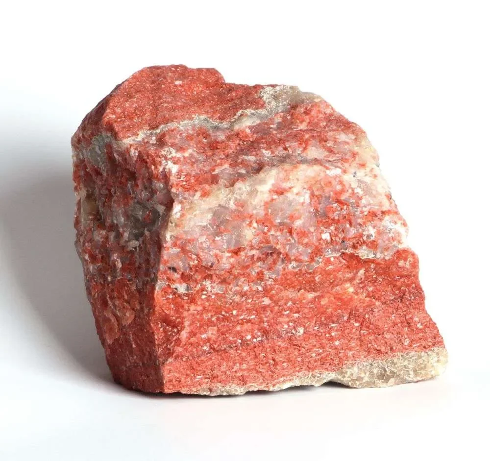
Germany has significant deposits of lignite (brown coal), rock salt, potash, limestone, and construction materials such as sand, gravel, and clay.
Lignite is an important energy source for electricity generation.
Potash is used in fertilizer production and is one of Germany's most valuable mineral exports.
Rock salt is used in chemical applications, food processing, and road de-icing.
Limestone, sand, and gravel support Germany's large construction industry.

Coal mining can destroy habitats and contribute to air pollution and greenhouse gas emissions. Large open-pit lignite mines have required the relocation of some communities. Unfortunately, coal is how most electricity is created, so there seems to be little being done to stop this.
Mining and processing provide jobs and contribute to exports, especially potash fertilizer, which is sold mostly to North America, South America, Europe, and China.
Earthquakes and Mountain Ranges
As mentioned earlier, Germany does not suffer from major earthquakes because it does not lie along any fault lines. In addition to the aforementioned Roermond Earthquake in 1992, another sizable earthquake in modern history was the 1978 Swabian Jura Earthquake. It had a magnitude of 5.7 and originated in southwestern Germany. Buildings were damaged, and several people were injured.
To prepare for earthquakes, Germany uses seismic monitoring systems, earthquake-resistant building codes, hazard maps, and emergency planning programs to reduce risks to citizens. Seismic monitoring is done by the German Research Center for Geoscience (GFZ).

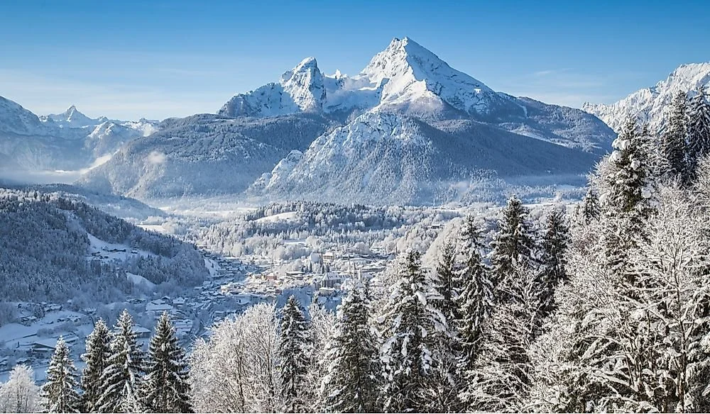
The Alps in southern Germany are the most important range. I have talked about it already, and I will continue to do so. The highest peak in Germany is Zugspitze (2,962 m / 9,718 ft). It has steep slopes, sharp peaks, and glacial valleys. The Alps cause increased rainfall and snowfall. Snowmelt from the Alps flows into many rivers, such as the Danube River. Tourism in the Alps is also a major part of the local economy. Historically, the Alps served as a barrier, with only a few passes to cross. This made invasions very difficult. Nowadays, there are modern highways, railways, and tunnels all over the range.
There is another mountain range I want to mention: the Central Uplands. It is a collection of several lower mountain ranges such as the Black Forest, Ore Mountains, and Thuringian Forest. These mountains are older and more eroded than the Alps. They range from 500 to 1,500 meters in elevation.
Volcanoes
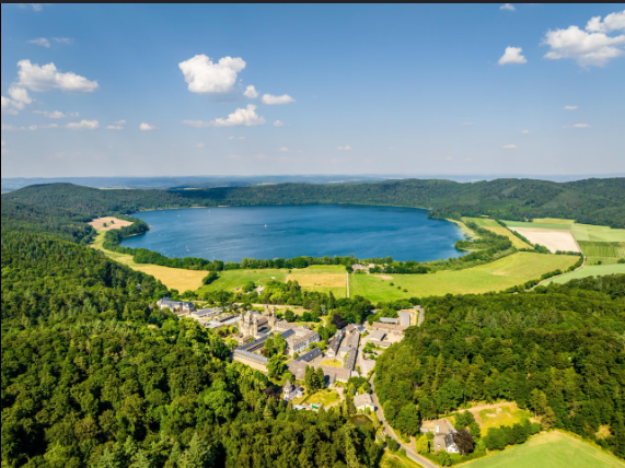
Germany has several volcanic regions, even though it does not have any active volcanoes today. The most important is the Eifel region in western Germany, which includes Laacher See, a caldera volcano formed by a massive eruption about 13,000 years ago. The funny thing is that it basically just looks like a normal lake now, except for the fact that it is two to ten kilometers deep. Another volcanic area is Kaiserstuhl in southwestern Germany.
These volcanoes help create fertile soil and attract tourists. The Laacher See eruption spread ash across much of Europe and damaged nearby forests. Today, Germany's volcanoes are considered dormant, but scientists still monitor the Eifel region for volcanic activity.